Google Middle Earth
 | |
 | |
| Mantainer(s) | Sauron |
|---|---|
| Stable release | Mirkwood, 1446 (3rd Age) |
| Preview release | Númenor, 2017 (2nd Age) |
| Operating system | DOS, BASIC, Windows |
| Percentage of users | 0.005% |
“Oh, I have got to update this Khazad-dum section. I’ve watched that same orc scratch his butt for the past seven hundred fifty-five years.”
– Sauron
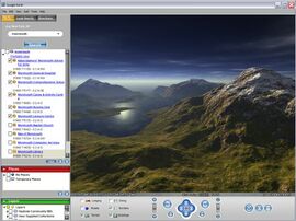
Google Middle Earth (GME) is a palantir-driven geographical simulation program of Middle Earth. It was created by weblord Sauron and is powered primarily by software giant Google.[1] Sauron himself has frequently obscured the tool's existence,[2] instead fostering the perception that his near-omniscience derives from a colorful vagina-shaped eyeball.

Summary
Recalling his most early efforts as a powerful servant of Aulë the Smith, Sauron temporarily set aside ringmaking during the Second Age and rolled up his sleeves for a new project. Using palantir imagery from Beleriand to Númenor, GME stitched together a lifelike, almost real-time model that could be zoomed in to view locations in great detail.
The beta version was unfortunately wiped out in 3319 of the Second Age when Númenor experienced catastrophic failure and sank beneath the sea. Returning to form quite some time later as the Necromancer of Mirkwood, the penultimate evil in Middle Earth redeveloped GME and later transferred its operating system to The Sauron Station at Barad-dur.

3D Structures
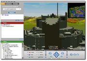
Following much shoulder-tapping by the Witch King of Angmar, who wanted better topology and function in order to achieve complete victory in his assault upon Minas Ithil, Sauron sighed and took a few moments away from subverting some Southrons in order to create a plugin that made blocky gray structures. The Lord of the Nazgûl finished reducing the citadel within six months.
Resolution
GME's accuracy is as good as 30m per pixel in the countryside, and urban areas are covered up to 1m per pixel. Most roads are not marked, however, as only the Dark Lord of Mordor and a handful of his chief servants use the program: they have been around so long they know all the roads and are too lazy to fill the names in.
Images are taken only at most every five hundred years as Sauron must sit through and manage the entire process. He is only a four-fingered typist, and the small programming team at Barad-dur does not have much time away from regular day-to-day activities such as marshalling, torturing, intimidating and midnight poker championships.
Going forward
Rumor has it that future versions of Google Earth will include people waving and doing sign language.[3][4]
Criticisms
Need for updates after wars and disasters
Images in many places are over a thousand years old and consequently do not capture more recent events. Númenor is still shown as in existence (though this may be due to Sauron’s sentimentality), and the area around the Lonely Mountain remains as it was when burned and terrorized by Smaug the Golden.
Nonexistent help function
The main user was not a particularly caring individual, and so did not bother to program a Help function. If he did, he'd be a fool. Also, the program becomes very unstable on Windoze platforms. Trying it on Macintosh didn't help either, but it has been known to work on Linux and other alternative software. No wonder Bill Gates hasn't been very happy recently.
National security and privacy issues
King Marcuul II of Far Harad complained that the imagery of his nation was too detailed, especially around his royal yurt. Sauron disintegrated him. Taking the cue, there were no further complaints from Mordor’s allies.
The area around the Black Gate was obscured through pixelization prior to the Battle of Dagorlad in 3434 of the Second Age, as Sauron feared through industrial espionage the Last Alliance of Elves and Men might prove victorious. Just before the battle, GME and The Sauron Station were moved to an undisclosed location in the Misty Mountains to stop the software from falling into the hands of the enemy.
The defenses at Osgiliath were not censored possibly leading to the defeat of its garrison. Footnotes were placed on the defenses by a [LOTR]DarkLord15. At press time the Gondor Defense Department did not comment on whether this was true.
Secret user comment
“O, I was a lover of wind and foam
Before elves crossed its girth
And I sigh with pleasure when I roam
This land so Valar-birthed.
But most amusement do I derive
Peeking on the little tribes
Through Google Middle Earth!”– T. B.
See also
Notes
- ↑ A pun on giant here is tempting but difficult due to their absence in the Middle Earth mythology.
- ↑ The appearance of this footnote helps make a potentially controversial statement of truth less shocking at first.
- ↑ Including hot babes in the shower!
- ↑ Google officially "abhors Easter eggs".


