Interstate 95
Interstate 95 | |
| |
| Length: | Stopped counting at 1 mile |
|---|---|
| Formed: | July 4, 1776 |
| South end: | Destroyed by hurricanes, alligators, sinkholes, and Florida Man |
| North end: | |
| System: | Jerry Seinfeld Interstate Highway System |
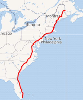
Interstate 95 is a multi-lane highway that goes through the affluent Eastern Seaboard states. It is America's most prestigious highway, and the farther north one drives, the more sophisticated and woke it becomes, before somehow ending up in Antarctica. It was born from President Eisenhower's communist plot to invest billions of hard-earned American tax dollars into roads that free-loading lazy people could use for free. Fortunately over time, some states (especially Jew Jersey) have introduced tolls. The road takes on different qualities in different states, ranging from Washington D.C.'s shriveled-grape sized section to New York's parking lot, to Florida's ashtray and refuse dump for discarded beer cans, and to Maine's void of nothing.
History[edit | edit source]
The original interstate was dreamed up by the Founding Fathers, who believed the original 13 colonies could be connected by the most glorious dirt road the world has ever seen. By the end of the second World War, it was realized that asphalt is easier on a car's tires and transmission, and it was decided to pour molten gravel and tar so that America's beautiful countryside could be permanently scarred. During Eisenhower's socialist reign, he paved over America's traditional dirt roads. This angered many conservatives, particularly in the South who wanted the dirt roads preserved, as they contained Civil War artifacts as well as footprints made by slaves.
Mexico, Cuba, and Florida[edit | edit source]
Traffic jams, confusing signage, and the gates of hell being 500 meters away make traveling on this part of the highway difficult. An extension of Donald Trump's wall into the Gulf of Mexico and melted tires from the heat of the underworld further contribute to the blockage.
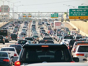
In Miami, I-95 experiences serious traffic constipation congestion, due to large numbers of demon vehicles merging in from the Pandaemonium Beltway. Heading north, you'll be able to see the Devil's mansion on your left, with the souls of the damned being collected from car wrecks as they crash.
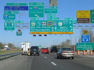
I-95 fornicates with Florida's Turnpike from Miami to Yomami. From there, it continues towards the clusterfuck with Interstate 4 (see photo on the right). This is designed to keep tourists from getting to Walt Disney World, and to instead force them to go to the incredible Ritz Theatre.
After that mess for which Han Solo apologizes, I-95 intersects Interstate 10's eastern terminus in Andrew Jacksonville. The city takes its name from the guy who kicked the Seminoles out of the area and forced them to share land with Yoda and Kermit the Frog in the Neverglades.
Georgia[edit | edit source]
Oh great, it's another political battleground state. Seriously, though, the portion of I-95 in Georgia is very politically contentious. Protesters blocked the highway after the 2020 US presidential election.
In addition, the highway goes past a nuclear facility, and nuclear bombs occasionally blow up. But what's scarier is a bomb half a mile off the coast. If that bomb blew up, it would completely destroy I-95, giving Interstate 5 the title of longest parking lot, and permanently cutting off Savannah from Jacksonville.
Carolinas[edit | edit source]
Nobody cares about South Carolina's portion, and they are seriously jealous of North Carolina's superior asphalt and major airport hubs. South Carolina suffers from brain drain, and it shows through the amount of dangerous potholes and abandoned signs on their stretch of the interstate. The North Carolina section was added shortly after the illustrious D.C. portion, and they have absolutely handsome roads. South Carolina desires to join North Carolina to make a Super Carolina (with a super highway), but America doesn't want to go back to the 49 star flag!
Virginia[edit | edit source]

And then, I-95 enters Virginia. US 1 also parallels the route, but nobody cares. Within Richmond, the route used to be tolled as the Richmond Penisburg Turnpike into Richmond, but the tolls were removed only to be replaced by tolls farther north closer to DC.
The portion between Springfield and Richmond is the most congested highway in the country. Virginia couldn't bother to add more than one lane in each direction.
I-95 was going to be routed into DC, but no one wanted a major highway so close to the Pentagon or Capitol for safety reasons. So, that route became I-395. The Springfield Interchange was constructed, which is a clusterfuck known as the "Mixing Bowl". It brings I-95 onto the Capital Beltway (I-495). The signage there was designed by 1st graders at a local elementary school. Unfortunately, they hadn't learned compass directions yet, so it's confusing. The signs label going west on the Beltway as "North" (Tysons), going north on I-395 as "North" (Washington), and going east toward Maryland as "North" (Baltimore). Bless their little hearts for trying. From there, I-95 heads east (yes kids, east) toward the Woodrow Wilson Bridge. This section has traffic all day and night until you reach DC and Maryland.
DC[edit | edit source]
“It's not a row of wood.”
I-95 uses the Woodrow Wilson Bridge to cross the Potomac into DC and then Maryland. The 0.11 miles that pass through Washington D.C. are the most sacred and holy parts of the highway. Each hundredth of a mile is dedicated to one of America's great presidents. As there were only 5 great presidents, the remaining 0.06 miles are dedicated to some social justice activists who made lives better for some minority nobody cares about.
Maryland[edit | edit source]
I-95 continues using the Capital Beltway until it connects to the ACTUAL routing of I-95. The portions south of the junction were never built because I said so.
It then continues towards Baltimore, where I have good news and bad news:
- Bad: Baltimore has crime.
- Good: A military fort protects I-95.
- Bad: The fort is no longer in service and is also a museum.
- Good: Underwater tunnel provides better protection.
- Bad: The tunnel leaks.
- Good: Alternate route: I-895. It has a tunnel, too.
- Bad: That tunnel leaks as well.
- Good: Alternate alternate route: I-695. BRIDGE!!!
- Bad: The bridge is tolled.
- Good: You can avoid the toll by instead going clockwise on I-695.
- Bad: That is 30 miles out of your way.
- Good: You can instead get off I-95 earlier in Prince George's County and head east on US 50, which can actually take you into Delaware by cutting across to Route 54.
- Bad: You miss the northern half of Maryland and go instead through all of Delaware.
- Good: Delaware has less traffic.
- Bad: Southern Delaware has no highways.
- Good: You can take the ferry on US 9 to get to southern Jew Jersey
- Bad: That's way the fuck outta your way, and aside from a parkway, you won't hit civilization for like another 120 miles.
- Good: There is no traffic.
- Bad: Red lights and isolation is worse than traffic.
Make your own decision here.
Delaware[edit | edit source]
After I-95 continues 11 miles into Delaware, it gets blocked by a wall. This wall was built by Donald Trump's Mexican Corps of Engineers in defiance of Joe Biden, who resides in Delaware. The wall traverses through Wilmington as a "fuck you" to Joe Biden, as he cannot travel to his own shopping mall. This wall means that no one south of Wilmington can use I-95 to go north. But it doesn't affect traffic much because drivers can flank the wall via US 9, even though it does mean driving through fucking Pennsylvania. Still, the wall does keep Joe Biden from going to his favorite shopping mall.
Jew Jersey[edit | edit source]
Upon crossing into Jew Jersey, you initially just detect grassland with nothing in it. However, once you merge onto the Jew Jersey Turnpike, and cross Exit 10, there becomes way more traffic. You spend hours sitting just to move from an exit to the next, as you see all the other bridges and tunnels and wish you could go there. Eventually, you hit the George Washington Bridge, but it is already the next week by the time that happens.
New York and Connecticut[edit | edit source]
The first section of interstate 95 was built through NYC, and it actually predates the adventurous second world war. People needed to drive their horses and buggies from Manhattan to their country homes in Connecticut. The mad rush on Friday after the work week ended and hundreds of buggies all clogged the small roads (along with their train of negro servants and boxes with their finest china and seance equipment). This meant heavy traffic and frustrated rich and connected folk. Naturally a special road was created (funded by the plebeians who were content taking their overstuffed ferries and putrid underground trains). It was a roaring success and was soon copied in other states.
Road Island[edit | edit source]
Here, the route is known for covering all of the state's area by itself. Which is saying something, as it only runs for 69 kilometers through the state. Maybe it was having sex with itself.
Massachusetts[edit | edit source]
The section of I-95 in Massachusetts is believed to contain the Minotaur's maze, although no one has survived it to give accurate information. It goes around Boston, intersecting with US Route 1, I-295, I-495, I-90, and I-93. The last is especially important, as people often run away from the highway in an attempt to avoid grazing around forever.
Old New Hampshire[edit | edit source]
New Hampshire encourages drunk driving by placing a liquor store near exit 2. However, they ironically discourage drunk driving by making exit 2 the only toll exit on the route in this state. They only put the toll there in order to stop people from getting drunk on purpose to "accidentally" swerve into the nuclear power plant on exit 1. It is also known as the Blue Light Special Turnpike in this section.
Maine[edit | edit source]
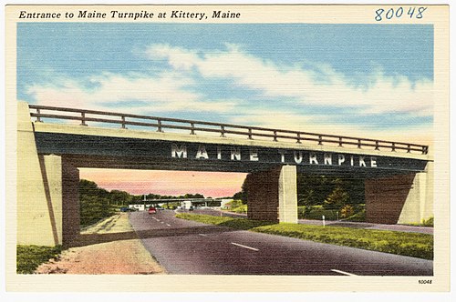
I-95 runs across the Maine Turnpike. Originally, I-95 used a different routing between Falmouth and Gardiner with I-295 (another one) serving as a loop through Portland — NOT Portland, Oregon; that would be I-205. I-495 used the turnpike between those two cities. However, Maine wanted to screw people over by changing the route numbers ironically to avoid screwing people over because I-95 is not 100 fucking percent of the Turnpike but nevertheless screws people over as I-95 is less direct, I-295 is longer, and I-495 moved but does not show itself on signs because it is a closeted gay.
Near Houlton, I-95 crosses into Canada. And ends. Well, at least the part of it people use.
New Brunswick[edit | edit source]
The section built in New Brusnwick is the only actual highway in Canada as they cannot afford their own multicarriage roads. People even drive all the way to NB (on Canada's two lane death trails) just to see what a proper American highway looks like. It is the pride of the Province and they even have a ceremony every year to thank Americans for civilising their nation.
Antarctica[edit | edit source]
After leaving Canada, I-95 continues east towards Antarctica (It is important to note this section of the road can be icy). This section also has absolutely no traffic because it goes literally Nowhere (take the exit to get there). The exit to Nowhere is called "the exit" because it's the only one, if you miss it, I-95 goes straight off a cliff due to global warming.
| Interstate Highways to as High as I can Count | ||||||||||||||||
|---|---|---|---|---|---|---|---|---|---|---|---|---|---|---|---|---|
| 0 | 1 | 2 | 3 | 4 | 5 | 6 | 7 | 8 | 9 | 10 | 11 | 12 | 13 | 14 | ||
| 15 | 16 | 17 | 18 | 19 | 20 | 21 | 22 | 23 | 24 | 25 | 26 | 27 | 28 | 29 | ||
| 30 | 31 | 32 | 33 | 34 | 35 | 36 | 37 | 38 | 39 | 40 | 41 | 42 | 43 | 44 | ||
| 45 | 46 | 47 | 48 | 49 | 50 | 51 | 52 | 53 | 54 | 55 | 56 | 57 | 58 | 59 | ||
| 60 | 61 | 62 | 63 | 64 | 65 | 66 | 66 (W) | 67 | 68 | 69 | 70 | 71 | 72 | 73 | ||
| 74 | 75 | 76 (W) | 76 (E) | 77 | 78 | 79 | 80 | 81 | 82 | 83 | 84 (W) | 84 (E) | 85 | 86 (W) | ||
| 86 (E) | 87 (N) | 87 (S) | 88 (W) | 88 (E) | 89 | 90 | 91 | 92 | 93 | 94 | 95 | 96 | 97 | 98 | ||
| 99 | ||||||||||||||||
| Higher than I can count | 100 | 101 | 102 | 180 | 278 | 287 | 391 | 420 | 476 | 478 | 523 | |||||
| 666 | 678 | 777 | 840 | 878 | 999 | |||||||||||
| US Highways | 41 | 64 | 66 | 74 | 76 | 101 | 220 | 411 | ||||||||
| The Outsiders | -1 | IC-69 | H-1 | H-2 | H-3 | H-201 | A-1 | A-2 | A-3 | A-4 | PRI-1 | PRI-2 | PRI-3 | |||
| America's Longest Toll Road | ||||||||||||||||
| Lists | Main - Auxiliary - Suffixed - Business - Unsigned Gaps - Intrastate - Interstate standards - Replaced | |||||||||||||||
includeonly>
