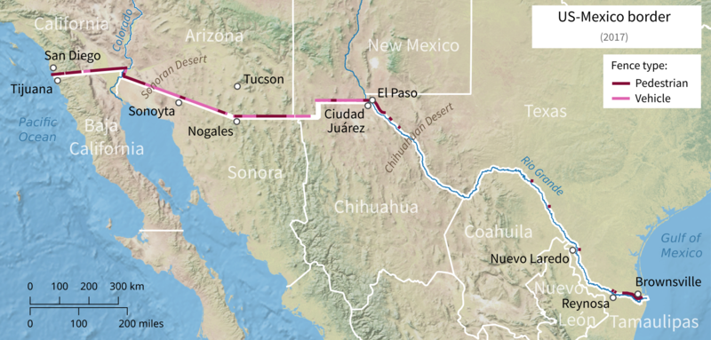
File:US-Mexico barrier map.png
Jump to navigation
Jump to search


Size of this preview: 800 × 383 pixels. Other resolution: 2,000 × 957 pixels.
Original file (2,000 × 957 pixels, file size: 2.57 MB, MIME type: image/png)
File history
Click on a date/time to view the file as it appeared at that time.
| Date/Time | Thumbnail | Dimensions | User | Comment | |
|---|---|---|---|---|---|
| current | 14:08, 22 January 2019 |  | 2,000 × 957 (2.57 MB) | wikimediacommons>Földhegy | {{Information |description={{en|Map of the {{w|Mexico–United States barrier}} as of 2017.}} |date=2019-01-22 |source={{own}}, based on data from [http://wapo.st/2CZjz6l The Washington Post] and the following map sources: * [http://www.naturalearthdata.com/ Natural Earth v1] * [http://gis-lab.info/qa/vmap0-eng.html VMap0] for borders * OpenStreetMap for waterways |author={{u|Földhegy}} |permission={{cc-by-sa-3.0}} {{ODbL OpenStreetMap}} |other versions= }} |
File usage
The following page uses this file:
