Category:Maps of the United Kingdom
Jump to navigation
Jump to search
Media in category "Maps of the United Kingdom"
The following 15 files are in this category, out of 15 total.
- 240px-Uk outline map.png 240 × 320; 32 KB
- 800px-Badger britain.png 800 × 581; 102 KB
- DerGrimNorth.PNG 642 × 802; 10 KB
- EnglandMap.jpg 400 × 299; 70 KB
- Europe middle earth.JPG 807 × 561; 77 KB
- Mapbarns.jpg 210 × 348; 15 KB
- Mapofengland.png 358 × 599; 59 KB
- Newukmap.png 312 × 676; 27 KB
- Niron.gif 751 × 587; 63 KB
- NorthSeaArchipelago.png 620 × 800; 26 KB
- Scotland from space.JPG 751 × 910; 107 KB
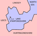
- Stamfordshire-County-Map.png 1,000 × 957; 54 KB
- Stamfordshire.png 168 × 254; 16 KB
- UKworld.png 608 × 340; 19 KB
- WalesLeicestershire.png 1,404 × 966; 10 KB


