Category:Maps
Jump to navigation
Jump to search
If you are confused, check with the sun
- Carry a compass to help you along
Your feet are going to be on the ground
- Your head is there to move you around, so
- Stand in the place where you live
Now face North
- Think about direction
Wonder why you haven't before
- Now stand in the place where you work
Now face West
- Think about the place where you live
Wonder why you haven't before
-REM
Subcategories
This category has the following 4 subcategories, out of 4 total.
*
- Maps of Europe (10 F)
M
- Maps of the United Kingdom (15 F)
- Maps of the United States (4 F)
W
- World maps (1 P, 24 F)
Pages in category "Maps"
The following 3 pages are in this category, out of 3 total.
Media in category "Maps"
The following 200 files are in this category, out of 239 total.
(previous page) (next page)- !0Russia-map.png 800 × 351; 50 KB
- 'istans.jpg 951 × 998; 646 KB
- 's hat.jpg 450 × 300; 19 KB
- 180px-Latin America terrain.jpg 180 × 172; 7 KB
- 180px-Macau-CIA WFB Map.JPG 180 × 193; 8 KB
- 1960 election.png 1,182 × 635; 63 KB
- 2004world.jpg 800 × 480; 40 KB
- 2008 US election.png 881 × 574; 35 KB
- 2008 US labels.png 881 × 574; 47 KB
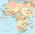
- 200px-Topography of africa.jpg 200 × 219; 11 KB
- 250px-EgyptLocation.png 352 × 188; 4 KB
- 250px-Macau Location.JPG 250 × 126; 5 KB
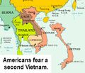
- 2ndvietnam.jpg 689 × 591; 90 KB
- 3 maps morocco.PNG 800 × 327; 60 KB
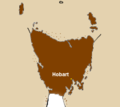
- 300px-Map-of-tassie 78 degrees.jpg 323 × 349; 9 KB
- 300px-Wolfisland.jpg 300 × 206; 32 KB
- 369px-Treasure.Island.map.jpg 369 × 598; 63 KB
- 400px-World Muslim Population Pew Forum.png 400 × 192; 41 KB
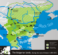
- 627px-Bulgaria Simeon I (893-927).svg.png 627 × 599; 152 KB
- Abkhazia detail map in portuguese.png 600 × 450; 32 KB
- Africa whattabattaheetbay.psd.jpg 400 × 386; 190 KB
- Africa-1-.gif 375 × 416; 15 KB
- Africanose.jpg 406 × 423; 32 KB
- AlaskaCanada.gif 595 × 526; 183 KB
- Aleutianbarrier.jpg 391 × 273; 20 KB
- Allahland.jpg 1,187 × 673; 69 KB
- America Map.JPG 1,513 × 983; 345 KB
- America now.jpg 680 × 511; 54 KB
- America.PNG 400 × 340; 16 KB
- Americainvasionmap.gif 601 × 384; 50 KB
- American Ocean Small.jpg 557 × 378; 76 KB
- Antarctica.jpg 418 × 328; 50 KB
- AO1.JPG 306 × 309; 18 KB
- Atlantis-before-it-sank.png 569 × 427; 16 KB
- Aust gold.jpg 289 × 216; 8 KB
- Australia-New Zealand.JPG 940 × 945; 177 KB
- Azerbaijani Map.jpg 1,244 × 1,058; 176 KB
- B4after.jpg 1,000 × 500; 551 KB
- Balkans02.jpg 420 × 343; 74 KB
- Battle of Italy 3.png 154 × 193; 5 KB
- Battle of Italy battle plan.png 154 × 193; 5 KB
- Belfast IE.jpg 198 × 257; 7 KB
- Bellinghammap.GIF 570 × 374; 10 KB
- Bermuda Islands.jpg 736 × 503; 107 KB
- Better Map of new jersey.jpg 630 × 574; 272 KB
- Birthplace.jpg 496 × 299; 25 KB
- Bluestates2000.gif 570 × 384; 10 KB
- Bluestates2004.gif 570 × 384; 10 KB
- Bluestates2008 v3.gif 570 × 384; 10 KB
- BMImap.png 650 × 427; 337 KB
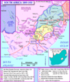
- BoerWarMap.gif 650 × 762; 145 KB
- BrazilEmpireMap.png 1,448 × 626; 18 KB
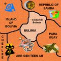
- Bulimia's map.JPG 300 × 300; 76 KB
- Burrard Inlet GJ.png 426 × 436; 14 KB
- Calimap.jpg 360 × 679; 30 KB
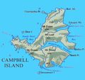
- Campbell Island.jpg 400 × 375; 59 KB
- CandyLand.png 480 × 400; 59 KB
- Cardiff.png 200 × 200; 82 KB
- Close up piritov map.png 708 × 415; 14 KB
- Colorado river.jpg 482 × 468; 197 KB
- Colorado.jpg 307 × 195; 6 KB
- Crimea 1.jpg 600 × 450; 30 KB
- Crimea 2.jpg 425 × 426; 174 KB
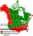
- Csa2000.JPG 325 × 351; 75 KB
- Cyprus-properties-map.JPG 375 × 220; 11 KB
- DJ01.jpg 619 × 353; 40 KB
- Djib.gif 409 × 312; 885 KB
- Dont cry for me.jpg 400 × 200; 15 KB
- Duckistan.gif 510 × 485; 37 KB
- Duckyyy.jpg 216 × 198; 22 KB
- Earthtimezones.jpg 474 × 301; 68 KB
- East Midz.jpg 455 × 381; 24 KB
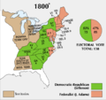
- ElectoralCollege1800-Large.png 675 × 636; 32 KB
- Emperor of Finland.gif 523 × 676; 16 KB
- Ernst Thälmann Island map (Wikimedia Maps screenshot retouched).png 1,000 × 662; 111 KB
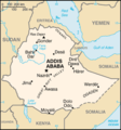
- EthiopiaMap.png 330 × 355; 12 KB
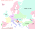
- EUROPE ACCORDING TO ALBANIA.png 3,500 × 2,917; 902 KB
- Exa.jpg 200 × 186; 31 KB
- Ff492b045c5282480f29fbe79e7d4265.gif 657 × 279; 49 KB
- Food-deprivation.jpg 526 × 356; 26 KB
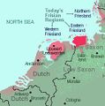
- Frisiamap.jpg 284 × 286; 17 KB
- GBnowales.jpg 203 × 192; 5 KB
- Gensokyo-Japan-Taiwan Empire.PNG 4,500 × 2,234; 107 KB
- Grand Greece.png 2,056 × 1,710; 120 KB
- Guyana map.jpg 330 × 500; 50 KB
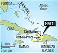
- Haitimap.jpg 219 × 201; 54 KB
- Heaven2.png 390 × 260; 234 KB
- Hilter Invasion Path.GIF 547 × 413; 76 KB
- Illinois.JPG 765 × 592; 77 KB
- Indiamap.jpg 1,129 × 1,202; 142 KB
- INewGreatMexicanReichMaP.png 1,448 × 626; 17 KB
- Interstate15map.png 237 × 378; 40 KB
- Invisia.gif 512 × 743; 135 KB
- Iquack.PNG 713 × 512; 68 KB
- Israel21.JPG 397 × 267; 39 KB
- Japan map.gif 388 × 407; 8 KB
- Keralamap.jpg 250 × 232; 8 KB
- Kg-map.gif 633 × 321; 17 KB
- Kingdomcome.jpg 225 × 188; 17 KB
- Kittenolivian location.PNG 888 × 504; 90 KB
- KrJpMap.gif 870 × 712; 79 KB
- Labrador3.jpg 458 × 427; 51 KB
- Lake Texcoco PreTenochtitlan.jpg 488 × 659; 188 KB
- Latin america.png 500 × 500; 11 KB
- Lietuva.jpg 300 × 294; 23 KB
- Location chile.PNG 1,357 × 628; 10 KB
- Location of South Africa.png 288 × 336; 3 KB
- LocationAfghanistan.png 250 × 115; 4 KB
- LocationCambodia.png 250 × 115; 3 KB
- LocationCanada.png 250 × 115; 13 KB
- LocationCzechRepublic.png 250 × 115; 4 KB
- LocationIndonesia.png 250 × 115; 12 KB
- LocationIran.png 250 × 165; 3 KB
- LocationLaos.png 250 × 125; 14 KB
- LocationLiechtenstein.png 250 × 115; 3 KB
- LocationPakistan.png 250 × 115; 4 KB
- LocationQatar.png 250 × 115; 3 KB
- Locations of the Czech Republic.jpg 1,024 × 768; 96 KB
- Long Island counties.png 255 × 140; 2 KB
- Luxembourg-actual-size.jpg 185 × 244; 20 KB
- M-d-line.gif 800 × 513; 39 KB
- Maddenmap.jpg 444 × 308; 99 KB
- MadeiraMap.jpg 200 × 251; 7 KB
- Map 2002.PNG 1,357 × 628; 17 KB
- Map 2009.PNG 1,357 × 628; 17 KB
- Map chile.jpg 360 × 1,750; 56 KB
- Map Duckist Ireland 2007.JPG 696 × 590; 34 KB
- Map of Australian states.jpg 699 × 628; 138 KB
- Map of burgonia.JPG 290 × 133; 6 KB
- Map of macedonia.png 1,032 × 927; 121 KB
- Map of Mongolia.jpg 320 × 251; 63 KB
- Map of Sicily - Province of Gela.png 781 × 600; 88 KB
- Map of South America.png 195 × 304; 3 KB
- Map of USA highlighting Georgia.png 280 × 183; 35 KB
- Map of USA with county outlines.jpg 774 × 504; 104 KB
- Map-eastcoast.gif 306 × 535; 15 KB
- Map.gif 583 × 386; 30 KB
- Map.PNG 1,357 × 628; 17 KB
- Mapa-dominicano.gif 400 × 269; 90 KB
- Mapav3.JPG 547 × 460; 41 KB
- Mapav4.JPG 714 × 600; 60 KB
- MapCheeselen.png 800 × 495; 24 KB
- Mapindia.GIF 415 × 405; 17 KB
- MapOldUS.jpg 333 × 286; 24 KB
- MarcoPoloTravels.jpg 317 × 272; 37 KB
- May2024SSTs.gif 1,080 × 550; 152 KB
- Mayo1.gif 580 × 579; 57 KB
- Mcmap.jpg 491 × 357; 98 KB
- Megatokyomap.JPG 270 × 122; 10 KB
- MOMap-doton-Joplin.png 300 × 263; 13 KB
- Montreal3.PNG 609 × 528; 28 KB
- MormonTrailMap.png 642 × 401; 7 KB
- N america pol.png 1,153 × 1,331; 478 KB
- NAFTAstan.jpg 927 × 621; 277 KB
- NarniaMap.PNG 450 × 291; 160 KB
- NeoUSSRmap.jpg 600 × 277; 14 KB
- Netherlands-Uncycl.jpg 1,066 × 793; 77 KB
- Newbritain.PNG 453 × 497; 101 KB
- Newnewmap.jpg 320 × 277; 19 KB
- Newpanama.jpg 159 × 199; 5 KB
- NewYorkHereBeDragons.png 768 × 600; 40 KB
- Nfldead.png 680 × 599; 251 KB
- Nippomap.jpg 329 × 353; 37 KB
- North Korea.png 377 × 298; 33 KB
- Not So Awesome Land.png 1,425 × 625; 353 KB
- Novayazemlya.jpg 430 × 453; 74 KB
- Nunavut.jpg 300 × 317; 21 KB
- Objective map of California.png 816 × 1,055; 93 KB
- Ohio States of America.JPG 707 × 480; 37 KB
- Oklahoma-in-usa.png 250 × 167; 4 KB
- Old Java Map.jpg 3,000 × 2,088; 1.12 MB
- Oss.gif 364 × 289; 24 KB
- Pacific ocean.jpg 351 × 356; 42 KB
- Penismap.JPG 375 × 498; 31 KB
- Pirate map.PNG 572 × 429; 240 KB
- Piruzao enorme ai como era grande.jpg 520 × 730; 67 KB
- Piruzao enorme.jpg 520 × 730; 63 KB
- PokemonIsland.png 500 × 500; 483 KB
- Political map of Ireland - Culchie Lands.png 800 × 1,000; 137 KB
- Political map of Ireland - Fecking Gaeltacht.png 800 × 1,000; 136 KB
- Political map of Ireland - Gaeltach 2.0.png 800 × 1,000; 134 KB
- Political map of Ireland - Mayo.png 800 × 1,000; 134 KB
- Political map of Ireland - Norn Iron.png 800 × 1,000; 135 KB
- Portuguese Timor.jpg 772 × 600; 53 KB
- Pubic hair.png 450 × 400; 22 KB
- Reaganworld.png 800 × 566; 415 KB
- Real-map-of-hyperborea.jpg 3,000 × 3,000; 1.91 MB
- Redstates of real america the one from red dawn dammit.png 464 × 291; 22 KB
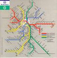
- Rer01 map.jpg 785 × 795; 101 KB
- Reykmap.JPG 348 × 264; 21 KB
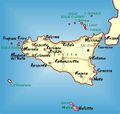
- Rich sicilyjust laying there.jpg 400 × 379; 25 KB
- Risk-australia.jpg 500 × 500; 29 KB
- Romulan-empire.jpg 291 × 190; 26 KB
- Rtcmaplg2.jpg 754 × 572; 69 KB
- Sacto.jpg 346 × 396; 34 KB
- Sanguo map.jpg 550 × 515; 73 KB
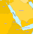
- Saudi araaabia.PNG 1,427 × 628; 16 KB
- SC map.gif 1,018 × 782; 22 KB
- Serbia future2.PNG 654 × 505; 82 KB
- Shetlandbox.gif 221 × 300; 7 KB

