File:Départements et régions de France.svg
Jump to navigation
Jump to search

Size of this PNG preview of this SVG file: 588 × 550 pixels. Other resolution: 2,190 × 2,048 pixels.
Original file (SVG file, nominally 588 × 550 pixels, file size: 362 KB)
This is a file from Wikimedia Commons. Information from its description page there is shown below.
Commons is a freely licensed media file repository. You can help, but they'd probably rather you didn't. |
Summary
| Description |
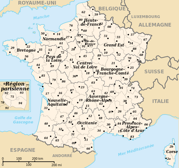
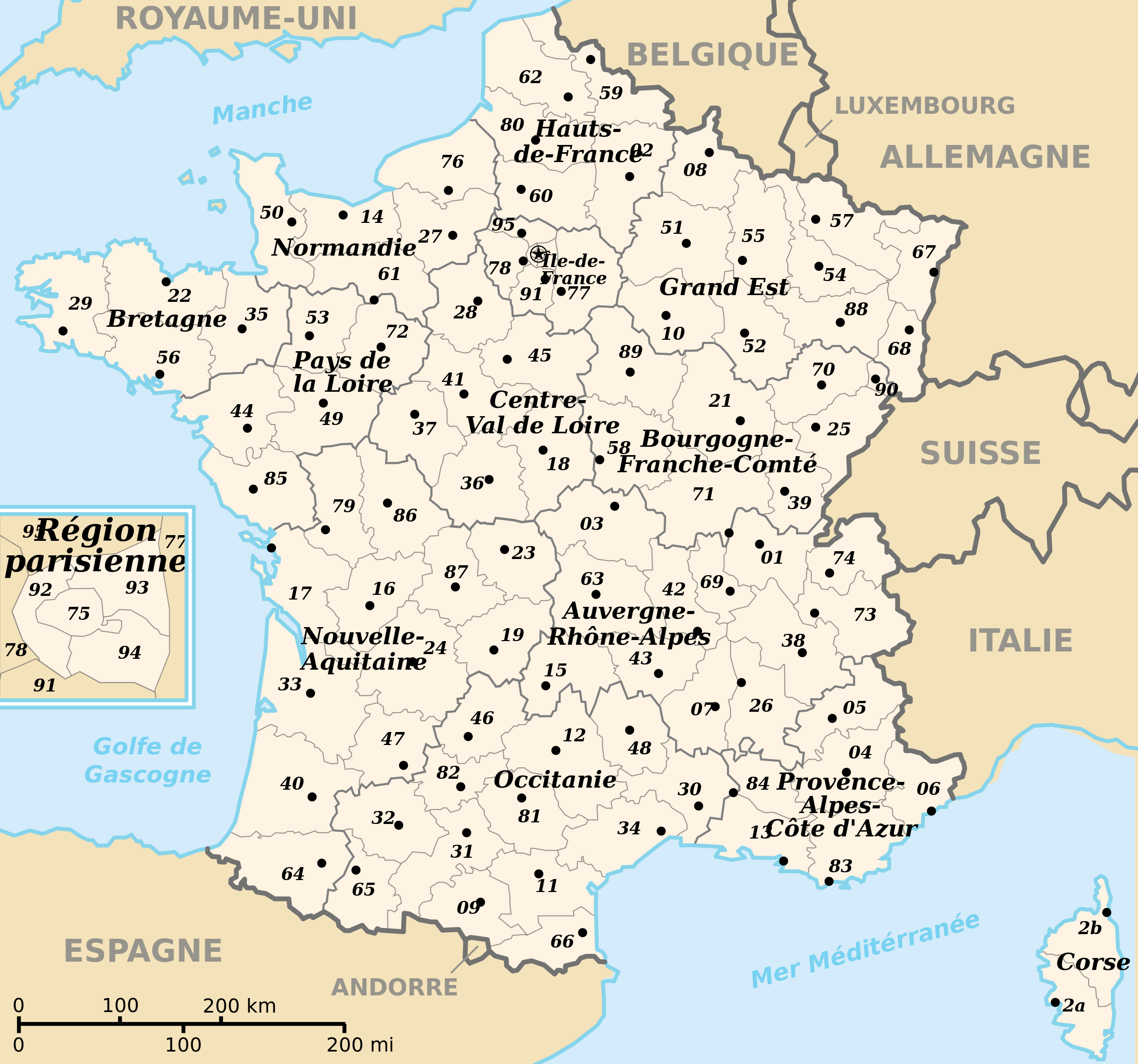
 English: Departements and region of France. French geographics objects use ISO 3166-2:FR for ids.
Español: Mapa de los departamentos franceses.
Français : Départements et régions de France avec leurs préfectures. Les objects géographiques français utilisent les identifiants provenant de ISO 3166-2:FR |
||
| Date | |||
| Source | Own work | ||
| Author | bayo | ||
| Permission (Reusing this file) |
|
||
| Other versions |
[]
|
![(français) Départements (numérotés) et régions de France avant 01/01/2016 (nommées, non colorisés) [source of all the following derivatives]](http://commons.wikimedia.org/wiki/File:D%C3%A9partements_et_r%C3%A9gions_de_France.svg)


![(français) Départements (numérotés) et régions de France avant 01/01/2016 (non nommées, non colorisées) [rendu amélioré] (version utilisée pour rendre la carte clicable par département)](http://commons.wikimedia.org/wiki/File:D%C3%A9partements_et_r%C3%A9gions_de_France_-_Noname-2016.svg)


![(français) Départements (numérotés) et régions de France avant 01/01/2016 (nommées et colorisées) [regions named/colored]](http://commons.wikimedia.org/wiki/File:D%C3%A9partements%2Br%C3%A9gions_(France).svg)
![(français) Départements (numérotés) et régions de France avant 01/01/2016 (nommées et colorisées) [15% magnified, rapid JPEG format 5x faster]](http://commons.wikimedia.org/wiki/File:France_departements_regions_narrow.jpg)
![(français) Départements de France (numérotés, non colorisés)[numeric labels, uncolorized]](http://commons.wikimedia.org/wiki/File:D%C3%A9partements_de_France.svg)


![(multilingue) Départements de France (sans aucun libellé) [No labels]](http://commons.wikimedia.org/wiki/File:D%C3%A9partements_et_r%C3%A9gions_de_France_vide.svg)
File history
Click on a date/time to view the file as it appeared at that time.
| Date/Time | Thumbnail | Dimensions | User | Comment | |
|---|---|---|---|---|---|
| current | 11:50, 26 April 2024 | | 588 × 550 (362 KB) | wikimediacommons>Jack ma | - correction of region limits (closing of Grand Est and Nouvelle-Aquitaine) |
File usage
The following page uses this file: