File:Ottoman empire largest borders map.png
Jump to navigation
Jump to search


Size of this preview: 525 × 600 pixels. Other resolution: 700 × 800 pixels.
Original file (700 × 800 pixels, file size: 156 KB, MIME type: image/png)
This is a file from Wikimedia Commons. Information from its description page there is shown below.
Commons is a freely licensed media file repository. You can help, but they'd probably rather you didn't. |
Summary
| Description |
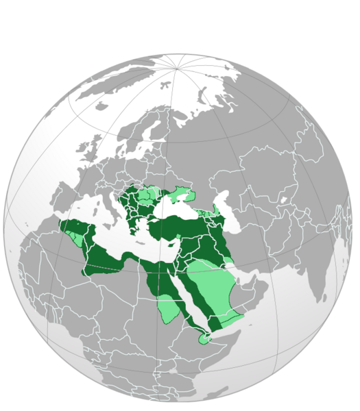
English: The borders of the Ottoman Empire in 1590 (before the long turkish war) |
| Date | |
| Source | Own work |
| Author | Siksok |

|
This map image could be re-created using vector graphics as an SVG file. This has several advantages; see Commons:Media for cleanup for more information. If an SVG form of this image is available, please upload it and afterwards replace this template with
{{vector version available|new image name}}.
It is recommended to name the SVG file “Ottoman empire largest borders map.svg”—then the template Vector version available (or Vva) does not need the new image name parameter. |
Licensing
I, the copyright holder of this work, hereby publish it under the following license:
This file is licensed under the Creative Commons Attribution-Share Alike 3.0 Unported license.
- You are free:
- to share – to copy, distribute and transmit the work
- to remix – to adapt the work
- Under the following conditions:
- attribution – You must give appropriate credit, provide a link to the license, and indicate if changes were made. You may do so in any reasonable manner, but not in any way that suggests the licensor endorses you or your use.
- share alike – If you remix, transform, or build upon the material, you must distribute your contributions under the same or compatible license as the original.
File history
Click on a date/time to view the file as it appeared at that time.
| Date/Time | Thumbnail | Dimensions | User | Comment | |
|---|---|---|---|---|---|
| current | 17:51, 14 July 2023 | | 700 × 800 (156 KB) | wikimediacommons>Bosphore9 |
File usage
The following page uses this file: