File:Map of USA Inland Northwest.png
Jump to navigation
Jump to search


No higher resolution available.
Map_of_USA_Inland_Northwest.png (280 × 183 pixels, file size: 17 KB, MIME type: image/png)
Summary[edit | edit source]
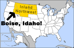
Inland Northwest. Original image from: http://en.wikipedia.org/wiki/Image:Map_of_USA_highlighting_North_Dakota.png
Licensed as "Permission is granted to copy, distribute and/or modify this document under the terms of the GNU Free Documentation License, Version 1.2 or any later version published by the Free Software Foundation; with no Invariant Sections, no Front-Cover Texts, and no Back-Cover Texts."
Licensing[edit | edit source]

Permission is granted to copy, distribute, modify, huff and/or misuse this document under the terms of the GNU Free Documentation License, with no Front Cover texts, Side Cover texts, Up Cover texts, Down Cover texts, Back Cover texts, Front Cover texts, and Invariant sections. Or not. You decide.
File history
Click on a date/time to view the file as it appeared at that time.
| Date/Time | Thumbnail | Dimensions | User | Comment | |
|---|---|---|---|---|---|
| current | 04:06, 13 June 2006 | | 280 × 183 (17 KB) | imported>I-Wanna-Be-Known-by-IP | Inland Northwest. Original image from: http://en.wikipedia.org/wiki/Image:Map_of_USA_highlighting_North_Dakota.png Licensed as "Permission is granted to copy, distribute and/or modify this document under the terms of the GNU Free Documentation License, V |
You cannot overwrite this file.
File usage
The following page uses this file: