File:Satellite image of the March 25, 2021 tornado outbreak.jpg
Jump to navigation
Jump to search

Size of this preview: 711 × 599 pixels. Other resolution: 2,416 × 2,037 pixels.
Original file (2,416 × 2,037 pixels, file size: 1.18 MB, MIME type: image/jpeg)
This is a file from Wikimedia Commons. Information from its description page there is shown below.
Commons is a freely licensed media file repository. You can help, but they'd probably rather you didn't. |
Summary
| Description |
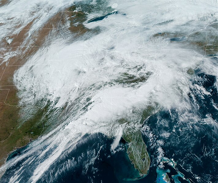
English: Satellite Imagery from GOES-16 of the storm system responsible of the Tornado Outbreak on March 25, 2021 |
| Date | |
| Source | https://cdn.star.nesdis.noaa.gov |
| Author | NOAA |
Licensing
This image is in the public domain because it contains materials that originally came from the U.S. National Oceanic and Atmospheric Administration, taken or made as part of an employee's official duties.
|
File history
Click on a date/time to view the file as it appeared at that time.
| Date/Time | Thumbnail | Dimensions | User | Comment | |
|---|---|---|---|---|---|
| current | 20:46, 25 March 2021 | | 2,416 × 2,037 (1.18 MB) | wikimediacommons>TheWxResearcher | Uploaded a work by NOAA from https://cdn.star.nesdis.noaa.gov with UploadWizard |
File usage
There are no pages that use this file.