File:MapofERPgantriesacrossisland.jpg
Jump to navigation
Jump to search


No higher resolution available.
MapofERPgantriesacrossisland.jpg (496 × 423 pixels, file size: 69 KB, MIME type: image/jpeg)
Summary[edit | edit source]
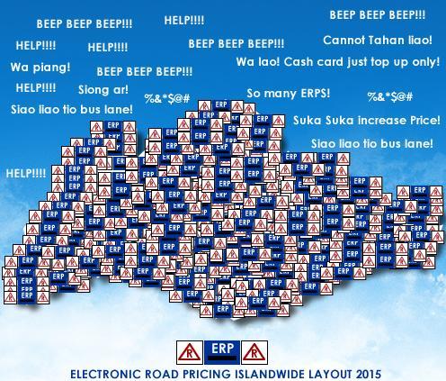
Map of ERP gantries across the island.
Licensing[edit | edit source]
No license selected: Unknown license!
This image has been uploaded without any license specified. The pitiful excuse by the uploader was: Don't know
File history
Click on a date/time to view the file as it appeared at that time.
| Date/Time | Thumbnail | Dimensions | User | Comment | |
|---|---|---|---|---|---|
| current | 16:53, 15 August 2008 | | 496 × 423 (69 KB) | imported>SporeMan43 | |
| 12:08, 12 July 2008 | 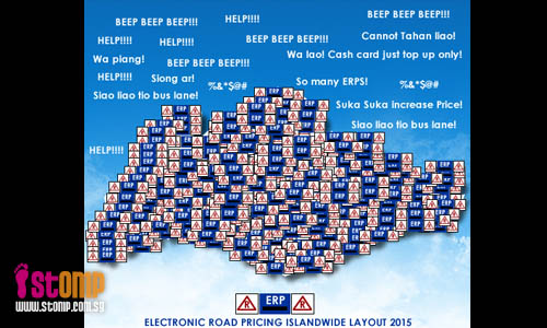 | 500 × 300 (69 KB) | imported>SporeMan43 | Map of ERP gantries across the island. |
You cannot overwrite this file.
File usage
The following page uses this file: