File:Ghent April 2012-2.jpg
Jump to navigation
Jump to search


Size of this preview: 800 × 377 pixels. Other resolutions: 2,560 × 1,205 pixels | 5,558 × 2,616 pixels.
Original file (5,558 × 2,616 pixels, file size: 9.77 MB, MIME type: image/jpeg)
This is a file from Wikimedia Commons. Information from its description page there is shown below.
Commons is a freely licensed media file repository. You can help, but they'd probably rather you didn't. |
Summary
| Description |
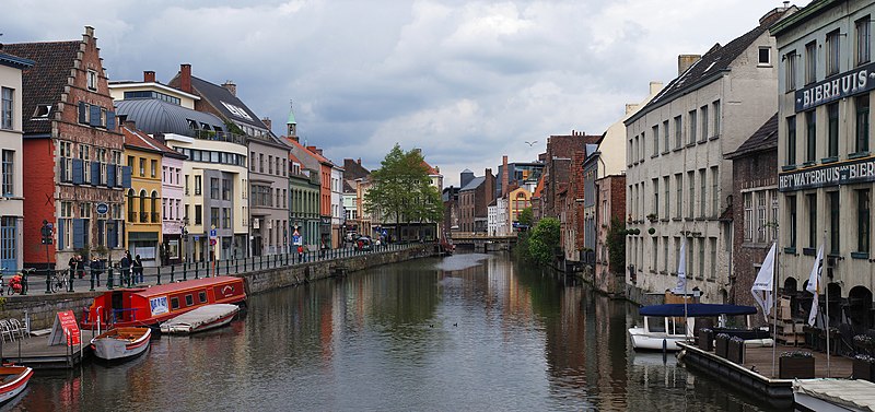
English: View of the Lys river in the centre of Ghent, Belgium.
Français : Gand, Belgique. Vue de la rivière Lys depuis le pont Vleeshuisbrug, dans le vieux centre-ville. Coup d'œil vers le nord-est. |
| Date | |
| Source | Own work |
| Author | Alvesgaspar |
| Camera location | | View this and other nearby images on: OpenStreetMap |
|---|
|
This image was selected as picture of the day on Wikimedia Commons for 30 May 2012. It was captioned as follows: English: View of a canal in the centre of Ghent, Belgium.
|
This image has been assessed using the Quality image guidelines and is considered a Quality image.
|
Licensing
I, the copyright holder of this work, hereby publish it under the following license:
This file is licensed under the Creative Commons Attribution-Share Alike 3.0 Unported license.
- You are free:
- to share – to copy, distribute and transmit the work
- to remix – to adapt the work
- Under the following conditions:
- attribution – You must give appropriate credit, provide a link to the license, and indicate if changes were made. You may do so in any reasonable manner, but not in any way that suggests the licensor endorses you or your use.
- share alike – If you remix, transform, or build upon the material, you must distribute your contributions under the same or compatible license as the original.
File history
Click on a date/time to view the file as it appeared at that time.
| Date/Time | Thumbnail | Dimensions | User | Comment | |
|---|---|---|---|---|---|
| current | 22:26, 29 April 2012 | | 5,558 × 2,616 (9.77 MB) | wikimediacommons>Alvesgaspar |
File usage
The following 2 pages use this file: