File:WTA Map.png
Jump to navigation
Jump to search


Size of this preview: 800 × 533 pixels. Other resolution: 1,200 × 800 pixels.
Original file (1,200 × 800 pixels, file size: 419 KB, MIME type: image/png)
Summary[edit | edit source]
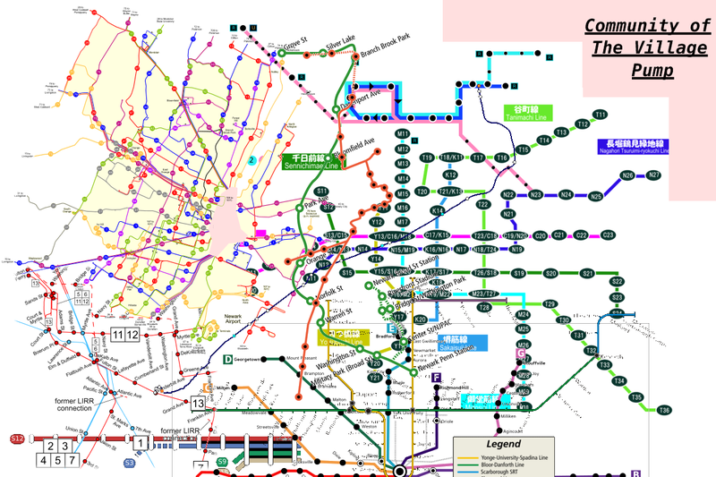
Map of the Wikipedia Transit Authority system. This map is made up of about 10 different system's maps.
Licensing[edit | edit source]
This work is licensed under Creative Commons Attribution-NonCommercial-ShareAlike 3.0. You're (probably) welcome to have your way with it, but only under those terms. Enjoy!
CC BY-NC-SA 3.0
File history
Click on a date/time to view the file as it appeared at that time.
| Date/Time | Thumbnail | Dimensions | User | Comment | |
|---|---|---|---|---|---|
| current | 02:22, 15 July 2008 | | 1,200 × 800 (419 KB) | imported>Enzo Aquarius | Map of the Wikipedia Transit Authority system. This map is made up of about 10 different system's maps. |
You cannot overwrite this file.
File usage
The following 3 pages use this file: