File:Geirangerfjord from Ørnesvingen, 2013 June.jpg
Jump to navigation
Jump to search


Size of this preview: 800 × 449 pixels. Other resolutions: 2,560 × 1,437 pixels | 6,520 × 3,660 pixels.
Original file (6,520 × 3,660 pixels, file size: 20.92 MB, MIME type: image/jpeg)
This is a file from Wikimedia Commons. Information from its description page there is shown below.
Commons is a freely licensed media file repository. You can help, but they'd probably rather you didn't. |
Summary
| Description |
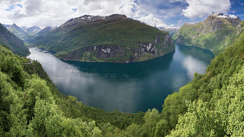
English: A view to Geirangerfjord from Ørnesvingen, Stranda, Møre og Romsdal, Norway in 2013 June. Français : Vue panoramique du Geirangerfjord depuis Ørnesvingen, Stranda, comté de Møre og Romsdal, Norvège. |
| Date | |
| Source | Own work |
| Author | Ximonic (Simo Räsänen) |
| Camera location | | View this and other nearby images on: OpenStreetMap |
|---|

|
NOTE: This image is a panorama consisting of multiple frames that were merged or stitched in software using a cylindrical projection. As a result, this image necessarily underwent some form of digital manipulation. These manipulations may include blending, blurring, cloning, and colour and perspective adjustments. As a result of these adjustments, the image content may be slightly different from reality at the points where multiple images were combined. This manipulation is often required due to lens, perspective, and parallax distortions.
|
|
This image was selected as picture of the day on Wikimedia Commons for 7 September 2013. It was captioned as follows: English: A view to Geirangerfjord from Ørnesvingen, Stranda, Møre og Romsdal, Norway in June 2013. Other languages:
English: A view to Geirangerfjord from Ørnesvingen, Stranda, Møre og Romsdal, Norway in June 2013. Magyar: Kilátás a Geiranger-fjordra Ørnesvingen felől 2013 júniusában (Møre og Romsdal megye, Norvégia) 中文: 挪威盖朗厄尔峡湾。 |
Licensing
I, the copyright holder of this work, hereby publish it under the following license:
This file is licensed under the Creative Commons Attribution-Share Alike 3.0 Unported license.
- You are free:
- to share – to copy, distribute and transmit the work
- to remix – to adapt the work
- Under the following conditions:
- attribution – You must give appropriate credit, provide a link to the license, and indicate if changes were made. You may do so in any reasonable manner, but not in any way that suggests the licensor endorses you or your use.
- share alike – If you remix, transform, or build upon the material, you must distribute your contributions under the same or compatible license as the original.
This image has been assessed using the Quality image guidelines and is considered a Quality image.
|
| Annotations | This image is annotated: View the annotations at Commons |
File history
Click on a date/time to view the file as it appeared at that time.
| Date/Time | Thumbnail | Dimensions | User | Comment | |
|---|---|---|---|---|---|
| current | 15:07, 29 September 2016 | | 6,520 × 3,660 (20.92 MB) | wikimediacommons>Ximonic | sRGB |
File usage
The following page uses this file: